Johnstone Strait and Into the Broughtons
Johnstone Strait has a bad reputation due to prevailing northwest winds that can whip down the Strait against the strong ebb tides and create very choppy, unpleasant conditions. Thus we paid careful attention to the weather forecasts for the days preceding and timed our transit with the phase of the moon that would mean less current. Preparation paid off, but there is no doubt that a lot of luck with the weather was involved. We had a brisk following wind and a favourable current that meant we were zooming along. Admittedly, just after leaving West Blenkinsop Bay things started out slow - so slow that we were lured into putting the spinnaker up. It took a good 20 minutes to get the rigging sorted out to hoist the Great Pumpkin (hey, the last time it flew was when it ripped about 4 miles from Victoria on the way home from Hawai'i!) Within about 10 minutes the winds were picking up and we were fishtailing along the Strait at great speeds. What a rush! Alas, it didn't really feel safe, so we grounded our poor pumpkin after a 20 minute flight.
We reached Hanson Island much earlier than expected so decided that we wouldn't stop to search for possible rich relatives that Bjarne could endear himself to. We carried on into the Broughton Islands in winds that had become very calm, at least some of the time. As we wiggled our way between various islands, both the winds and the currents varied considerably. Shortly after some calm motoring on peaceful mirrored seas that blended in with the gray skies, we were heeled over and tacking into 20 kt gusts.
The forecast had been for gale force winds so we tucked ourselves into Bootleg Cove, a little hidey hole that is not obviously apparent from Retreat Passage.
Echo Bay
We hid out in the cozy Bootleg Cove for a day and half, remaining undetected by the authorities. When the coast was clear, we made a mad dash (at about 1.5 knots) for nearby Echo Bay. For the next two days we were plagued by a 1980's pop tune (any guesses?)1 that kept popping into our minds like the rodents in a whack-a-mole game.
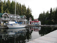
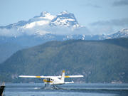
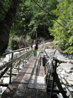
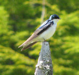
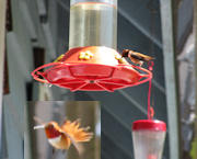
Because the Internet was free here, we had a hard time leaving. Wait! Just one more email to send...
We dragged ourselves away after lunch and tacked our way upwind a narrow channel (when you are tacking, pretty much every channel seems narrow) to reach Cullen Harbour on the south side of Broughton Island. We were too tired to bother exploring this harbour despite the many interesting possibilities. Sometimes one doesn't need to see yet another combination of rocks, trees and water2. We had a relaxing night and made a (reasonably) early start the next day.
Queen Charlotte Strait (En-Route to Port Hardy)
A calm morning in Queen Charolotte Strait.
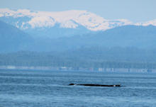
Port Hardy – Provisioning Stop
 Whaling
and slow sailing meant a later arrival in Port Hardy than planned. We
were concerned that the stores would be closing before we could get
our chores done. No need to worry about that – we arrived
during a power outage affecting all of North Vancouver Island. That
ruled out: hot showers, grocery shopping, getting rum, fueling up,
laundry, and using the Internet. Hmmm, now what? Hey, that pizza
place has a propane-fired oven! Well, dining-out was on the agenda,
too.
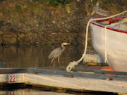
Wildlife spotting was surprisingly good in Port Hardy, despite us being at a marina. A big sea lion had claimed an old fuel dock, eagles perched on a nearby pagoda, and a heron stalked the docks. Additionally, the harbour was teeming with herring (fortunately, no red ones).
Goletas Channel, Nawhitti Bar and Cape Scott
In the Goletas channel, skirting the northeast coast of Vancouver Island, all was calm and the seas were gentle as we headed for the anchorage at Bull Harbour. Suddenly, the winds picked up to 20 kts on the nose and we rushed to reef the sail! Where the heck did that come from? This called for a re-evaluation of plans; there wasn't a lot of point in beating up wind if we could avoid it.
The bay we ducked into, Loquililla Cove, was very quiet except for the sea life that attacked the prop; the prop was well and truly tangled, necessitating that the person who backed over the kelp get in the kayak and untangle it. Patient use of the boat hook prevented a dip in the cold water.
Whilst kayaking about the bay we recovered a lifejacket washed up on the beach – with no person inside fortunately. Anyone knowing the whereabouts of the boat/person Tlatlasikwala, let them know we have their lifejacket...
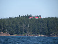 The
Nawhitti Bar is a feared crossing but gave us no problems thanks to
care in timing and favourable weather. Once past this bar we were
back into the Pacific Ocean swells. Been there, done that, didn't
really miss it. Ah well, the weather was fine and we had our first
glimpse of Sea Otters (not to be confused with River Otters, which
are commonly seen around the Victoria area [in the sea]). Very
exciting if you are there but the photo only shows little dark lumps
in the water – we have better photos coming later...
For those who likes beaches, the stretch of coast leading up to Cape Scott should be added to your list of travel sites. There are miles of beautiful, golden strands. Some of them are accessed by the Cape Scott hiking trail, a trek Bjarne did with his mom, dad and little sis when he was 12 years old. The trail is quite rugged; it is shorter than the West Coast Trail but less manicured (e.g. fewer boardwalks over bog-crossings), and can be rather wet, but oh, those beaches.
Rounding Cape Scott was unproblematic (not complaining). The winds and currents here can be fierce but on this day we were motoring around it in light winds with plenty of time to snap photos of the lighthouse. We made our way to Sea Otter Cove (named after a ship rather than possible inhabitants) and celebrated our first night on the West Coast.
Today, 15 June 2009, we are in Kyuquot tied up to the public dock. It's a tiny town of about 300 folks mainly engaged in fishing (year-round) and tourism, kayak and fishing charters during the summer months. We took a walk along main street last night, which consists of a well-worn dirt path meandering along the shore and through peoples' front and back yards. There's a good assortment of old-growth trees and salmon-berry bushes along the track that we paused to enjoy. We chatted with a fellow who's restoring the old schoolhouse for use as a hostel, and another local commented that in the winter it rains here for three months, steadily.
1 “Echo Beach” Martha and the Muffins
2 Check Out “Rocks and Trees” on the Arrogant Worms' album Dirt!